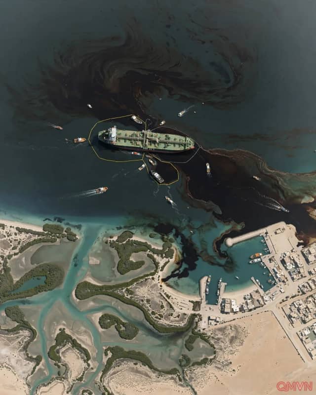
Satellite verification of spreading slick and regional beach shutdowns
Satellite imagery captured by the European Union's Copernicus Sentinel-2 constellation on October 24, 2026, revealed that an offshore oil slick has expanded aggressively over recent days, with dark surface layers drifting into immediate proximity with the northern emirate of Umm Al Quwain.
In response to imminent shoreline contamination, the UAE Ministry of Climate Change and Environment enacted immediate containment protocols, ordering the temporary closure of all public beaches and coastal zones around the city of Umm Al Quwain.